Category:Kasteel Duurstede
Jump to navigation
Jump to search
| Object location | | View all coordinates using: OpenStreetMap |
|---|
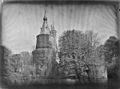
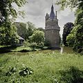
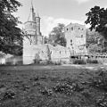
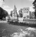
Castle in Wijk bij Duurstede, Utrecht province, Netherlands  | |||||
| Upload media | |||||
| Instance of | |||||
|---|---|---|---|---|---|
| Part of | |||||
| Location | Wijk bij Duurstede, Utrecht, Netherlands | ||||
| Street address |
| ||||
| Located on street | |||||
| Heritage designation |
| ||||
 | |||||
|
This is a category about rijksmonumentcomplex number 454178
|
Ruïne
|
This is a category about rijksmonument number 454308
|
Historische tuin- en parkaanleg:
|
This is a category about rijksmonument number 454310
|
Kasteelpoort (Hoenderpoort):
|
This is a category about rijksmonument number 454311
|
Brug bij kasteelpoort:
|
This is a category about rijksmonument number 454312
|
Brug:
|
This is a category about rijksmonument number 454313
|
| Address |
|
Subcategories
This category has the following 4 subcategories, out of 4 total.
D
- De Wildkamp, Wijk bij Duurstede (18 F)
- Drawings of Kasteel Duurstede (152 F)
M
R
- Ruins of Kasteel Duurstede (79 F)
Media in category "Kasteel Duurstede"
The following 84 files are in this category, out of 84 total.
-
 1209 Wijk bij Duurstede 125.JPG 2,797 × 1,763; 1.49 MB
-
 1209 Wijk bij Duurstede 142.JPG 3,431 × 2,436; 1.68 MB
-
 1209 Wijk bij Duurstede 152.JPG 3,415 × 2,423; 1.42 MB
-
 1209 Wijk bij Duurstede 154.JPG 3,400 × 2,411; 1.37 MB
-
 1209 Wijk bij Duurstede 155.JPG 3,462 × 2,459; 1.53 MB
-
 1209 Wijk bij Duurstede 163.JPG 3,579 × 2,546; 1.53 MB
-
 Donjon at duurstede.jpg 491 × 700; 112 KB
-
 Duurstede (3).JPG 1,000 × 665; 260 KB
-
 Duurstede front.jpg 1,000 × 664; 231 KB
-
 Duurstede.jpg 474 × 700; 86 KB
-
 Exterieur OVERZICHT - Wijk bij Duurstede - 20285845 - RCE.jpg 1,197 × 1,200; 322 KB
-
 Exterieur OVERZICHT - Wijk bij Duurstede - 20285846 - RCE.jpg 1,188 × 1,200; 424 KB
-
 Exterieur OVERZICHT - Wijk bij Duurstede - 20285847 - RCE.jpg 1,192 × 1,200; 487 KB
-
 Exterieur OVERZICHT - Wijk bij Duurstede - 20285848 - RCE.jpg 1,188 × 1,200; 444 KB
-
 Kasteel - Wijk bij Duurstede - 20213047 - RCE.jpg 900 × 1,200; 202 KB
-
 Kasteel - Wijk bij Duurstede - 20213048 - RCE.jpg 1,200 × 923; 282 KB
-
 Kasteel - Wijk bij Duurstede - 20213062 - RCE.jpg 915 × 1,200; 252 KB
-
 Kasteel - Wijk bij Duurstede - 20213064 - RCE.jpg 893 × 1,200; 278 KB
-
 Kasteel - Wijk bij Duurstede - 20213065 - RCE.jpg 892 × 1,200; 330 KB
-
 Kasteel - Wijk bij Duurstede - 20213066 - RCE.jpg 897 × 1,200; 295 KB
-
 Kasteel Duurstede - Wijk bij Duurstede - Rijksmonument (51081970026).jpg 4,724 × 3,149; 18.44 MB
-
 Kasteel Duurstede met park.jpg 9,083 × 6,055; 41.36 MB
-
 Kasteel Duurstede pano.JPG 5,123 × 2,448; 3.3 MB
-
 Kasteel Duurstede.jpg 485 × 365; 71 KB
-
 Kasteel Wijk vanDuren 00 22 26 480000.jpeg 3,024 × 4,032; 1.81 MB
-
 Kasteel Wijk vanDuren 00 22 32 548000.jpeg 3,024 × 4,032; 3.46 MB
-
 Kasteel Wijk vanDuren 00 22 42 770000.jpeg 4,032 × 3,024; 3.4 MB
-
 Kasteel Wijk vanDuren 00 22 51 351000.jpeg 3,024 × 4,032; 3.07 MB
-
 Kasteel Wijk vanDuren 00 22 59 541000.jpeg 4,032 × 3,024; 3.04 MB
-
 Kasteel Wijk vanDuren 00 23 07 927000.jpeg 3,024 × 4,032; 2.05 MB
-
 Kasteel Wijk vanDuren 00 23 15 320000.jpeg 3,024 × 4,032; 3.46 MB
-
 Kasteel Wijk vanDuren.jpeg 4,032 × 3,024; 2.84 MB
-
 Kasteel, aanzicht - Wijk bij Duurstede - 20213083 - RCE.jpg 850 × 1,200; 221 KB
-
 Kasteel, aanzicht - Wijk bij Duurstede - 20213084 - RCE.jpg 901 × 1,200; 218 KB
-
 KasteelDuurstede.jpg 3,264 × 2,448; 3.81 MB
-
 Kraagsteen in kasteel - Wijk bij Duurstede - 20213069 - RCE.jpg 1,200 × 885; 217 KB
-
 Kraagsteen van gewelf in kasteel - Wijk bij Duurstede - 20213068 - RCE.jpg 899 × 1,200; 168 KB
-

-
-
 Overzicht Donjon met toegangshek - Wijk bij Duurstede - 20213115 - RCE.jpg 1,200 × 1,200; 492 KB
-
 Overzicht met de ronde toren - Wijk bij Duurstede - 20339974 - RCE.jpg 1,176 × 1,200; 449 KB
-
 Overzicht met de ronde toren - Wijk bij Duurstede - 20339975 - RCE.jpg 1,185 × 1,200; 444 KB
-
 Overzicht met de ronde toren - Wijk bij Duurstede - 20396527 - RCE.jpg 1,200 × 1,200; 378 KB
-
 Overzicht met de ronde toren - Wijk bij Duurstede - 20396541 - RCE.jpg 1,200 × 1,200; 455 KB
-
 Overzicht met de ronde toren en de donjon - Wijk bij Duurstede - 20339972 - RCE.jpg 1,180 × 1,200; 392 KB
-
 Overzicht met de ronde toren en de donjon - Wijk bij Duurstede - 20396526 - RCE.jpg 1,200 × 1,199; 265 KB
-
-

-
-

-

-
 Overzicht van de ronde toren en de donjon - Wijk bij Duurstede - 20339973 - RCE.jpg 1,185 × 1,200; 323 KB
-
 Overzicht van de ronde toren en de donjon - Wijk bij Duurstede - 20396540 - RCE.jpg 1,200 × 1,200; 255 KB
-
 Ronde toren - Wijk bij Duurstede - 20213077 - RCE.jpg 894 × 1,200; 282 KB
-
 Slotwbd1756.jpg 590 × 506; 103 KB
-
 WbD EF Langs de Wal 6 HoenderpoortRM 454311.JPG 2,288 × 1,712; 1.25 MB
-
 WbD EF Langs de Wal 6 RM 454308.JPG 2,288 × 1,712; 1.15 MB
-
 WbD EF Langs de Wal 6 RM 454312.JPG 2,288 × 1,712; 1.18 MB
-
 WbD EF Langs de Wal 6 RM 454313.JPG 1,903 × 1,344; 770 KB
-
 WbD EF Monumenten De muziektent naast de donjon RM 454313.JPG 2,288 × 1,712; 1.38 MB
-
 WbD EF Monumenten Park en tuin RM 454313.JPG 2,288 × 1,712; 1.27 MB
-
 WbD EF Monumenten Richting Wildkamp RM 454313.JPG 2,288 × 1,712; 1.52 MB
-
 WbD EF Monumenten RM 454310 Tuin en plantsoen.JPG 2,288 × 1,712; 1.27 MB
-
 Wijk bij duurstede kasteel1.jpg 640 × 480; 298 KB
-
 Wijk bij duurstede kasteel2.jpg 480 × 640; 322 KB
-
 Wijk bij duurstede kasteel3.jpg 480 × 640; 248 KB
-
 Wijk bij Duurstede RM Kasteel Duurstede 1.jpg 3,845 × 3,402; 4.86 MB
-
 Wijk bij Duurstede RM Kasteel Duurstede 2.jpg 4,108 × 2,941; 5.04 MB
-
 Wijk bij Duurstede RM Kasteel Duurstede Vierkante toren.jpg 3,303 × 4,567; 5.25 MB
-
 Wijk bij Duurstede RM Kasteel te Duurstede Reliëf.jpg 4,010 × 2,764; 5.16 MB
-
 Wijk bij Duurstede, kasteel Duurstede RM454308 IMG 9213 2019-04-19 15.51.jpg 3,395 × 5,093; 10.61 MB
-
 Wijk bij Duurstede, kasteel Duurstede RM454308 positie3 foto4 2012-05-29 12.12.JPG 3,284 × 4,378; 7.97 MB
-
 Wijk bij Duurstede, Netherlands - panoramio (14).jpg 2,048 × 1,148; 588 KB
-
 Wijk bij Duurstede, Netherlands - panoramio (17).jpg 2,048 × 1,148; 694 KB
-
 Wijk bij Duurstede, Netherlands - panoramio (18).jpg 2,048 × 1,148; 559 KB
-
 Wijk bij Duurstede, Netherlands - panoramio (20).jpg 2,048 × 1,148; 568 KB
-
 Wijk bij Duurstede, Netherlands - panoramio (21).jpg 2,048 × 1,148; 915 KB
-
 Wijk bij Duurstede, Netherlands - panoramio (28).jpg 2,048 × 1,148; 545 KB
-
 Wijk bij Duurstede, Netherlands - panoramio (40).jpg 2,048 × 1,148; 711 KB
-
 Wijk bij Duurstede, Netherlands - panoramio (58).jpg 1,148 × 2,048; 587 KB
-
 Wijk bij Duurstede, Netherlands - panoramio - Ben Bender (7).jpg 4,896 × 3,264; 6.72 MB
-
 Wijk bij Duurstede, Netherlands - panoramio - Ben Bender (8).jpg 4,896 × 3,264; 6.3 MB
-
 Wijk bij Duurstede, Netherlands - panoramio - Ben Bender (9).jpg 4,896 × 3,264; 6.62 MB
-
 Zicht op het kasteel - Wijk bij Duurstede - 20375200 - RCE.jpg 1,196 × 1,200; 298 KB


.JPG)


.jpg)


.jpg)
.jpg)
.jpg)
.jpg)
.jpg)
.jpg)
.jpg)
.jpg)
.jpg)
.jpg)
.jpg)
